
Indie game storeFree gamesFun gamesHorror games
Game developmentAssetsComics
SalesBundles
Jobs
TagsGame Engines

TheFoeHammer

5
Posts
1
Topics
A member registered 45 days ago

Recent community posts

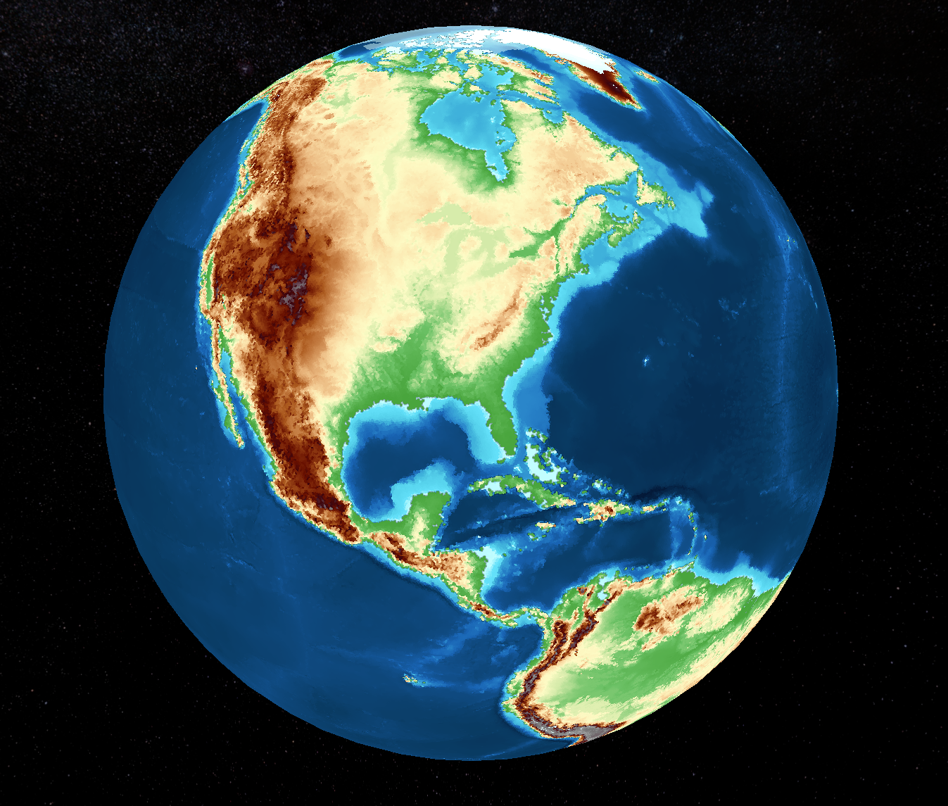
I did not understand. Let me explain my intention. I was trying to simulate Earth and project what it might look like far in the future. The height map of Earth worked great, but underneath, the plates do not match. So, I made the assumption that I would need to upload additional maps to show where the plates reside. Here is the height map: 
The plate map that was generated for the same location: 
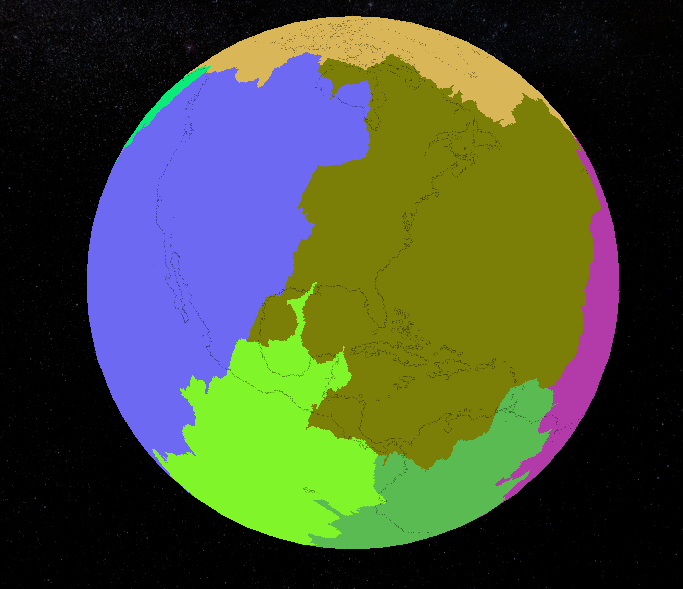
I thought that even a user creating a new world from scratch would want to import heights and plates. The screen that accepts the map imports has all three map options together. Maybe that lead me to believe all three should be uploaded.


I did not mean to lead anyone to believe that the program was not working properly. Sorry for any confusion on my part. Perhaps I did not understand the purpose of the program.

Thank you

Impressive work. This is truly great!

(1 edit)

That is beautiful! Looks like the height map even got the ocean currents correct. Thanks again!

So, to make this work properly, I would also need a plate map and a crust map. Gleba specifies that those need to be .png files. Do you have ideas on where I could grab files for those? I would assume that they need to be the same size (5400x2700) and orientation to match the height map. I'm new to this. So, any advice is a great help.


Edit: I just read your post on how to build these .png maps. I'm still concerned about the size and orientation of all three maps (height, crust, plate) needing to match. Will you please explain?

Excellent. Thank you so much. I will try it out soon.

Do you have a map of today's Earth that may be imported into Gelba?