This is one of few approaches I've tried to make good-looking mountains for hexagonal terrain map. If you are interested in others, please, let me know. Any comments/requests/suggestions are welcome.
Brief
The whole approach is based on Ridges. Ridge is fancy name for undirected graph. If we have group of N "mountain" hexes we can choose N points from each of them. Then we can create M (M < N) ridges by connecting N points in some order. Some trivial order will be presented below
Single tile
r1-r2 is just a line elevated at some point along Z axis. We want to make 3D shape from a line and flat hexagon. Let's calculate height of every point inside hexagon as linear interpolation from border level (assume it 0 in this post) and r1-r2 level (assume it Ridge level). R is radius of excircle, r - radius of incircle

Side and top views:

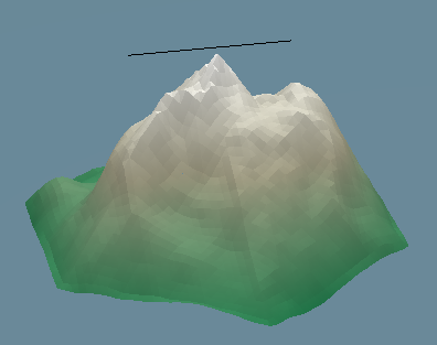
Let's render this idea. First picture does not include perlin noise, second - does include. Black line is ridge. Size of triangle in mesh is R/28.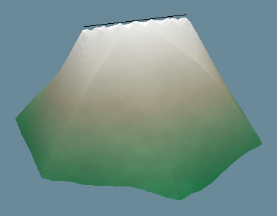
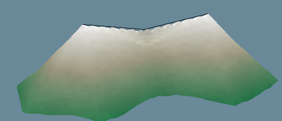
Two tiles
Nothing really interesting, same concept. "No Perlin noise" version is below. There are 3 points in ridge, middle point is slightly displaced.
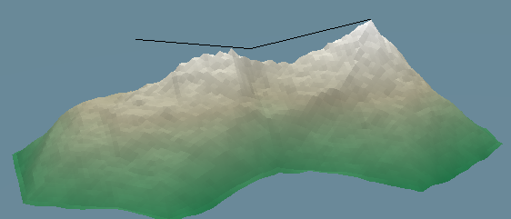
With noise:
We need more tiles
Let's look at group of tiles:
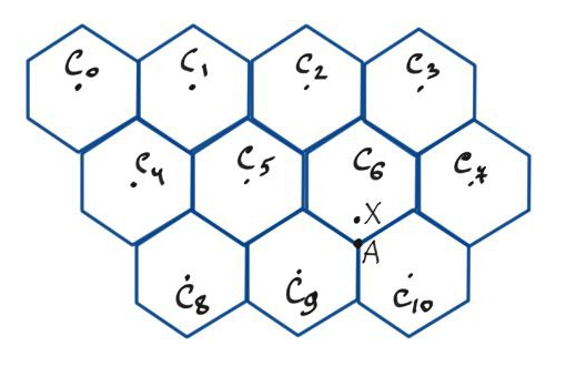
If we look at "border" tiles - all except C5, C6 - it's easy to calculate distance from every point inside of them to nearest border: there is formula of distance between line and point. If we look e.g. at point X, we can't calculate distance to border using tile C6 itself. We use information from neighbours:
So, for every point now we know distance to nearest border and distance to nearest ridge point (ridges are set by us). How can we arrange tiles in groups? By using Disjoint set union.
Next question, how we can decide which tile will be water tile, which - hill and which - mountain, etc? By using any algorithm which may be used to generate terrain: e.g. diamond square or Perlin noise. We calculate max and min of all heights and set thresholds. First, lets call amplitude = max - min. Next, let's assign water threshold = [0.0, 0.1] of amplitude, mountain - [0.9, 1.0] of amplitude. If we increase 0.1 -> 0.2 there will be more water tiles, if we decrease 0.9 -> 0.8 there will be more mountain tiles.
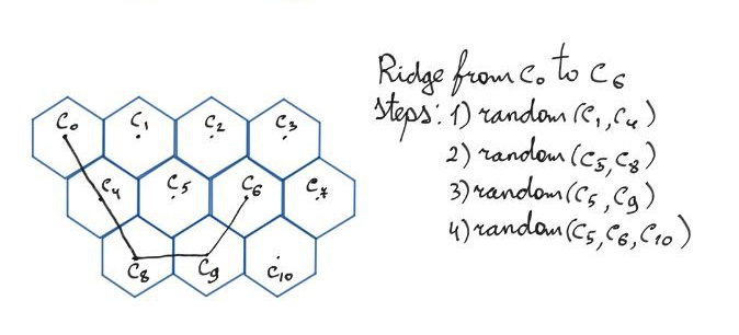
Finally, recall that we "know all ridges coordinates". But how? Surely, there is a lot of approaches how to set them. First I tried DLA algorithm but with no success. I'll show trivial made up algorithm. Let me remind, that at this point we know everything except positions of ridges. Algorithm is the following:
Let me show short illustration.
Concluding remark
We used Perlin noise to make shape more realistic. By using different set of parameters it's possible to make unnatural - but still pretty shapes. Compare pics below:
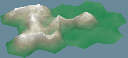
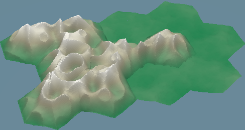
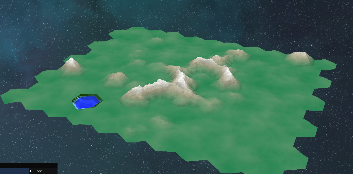
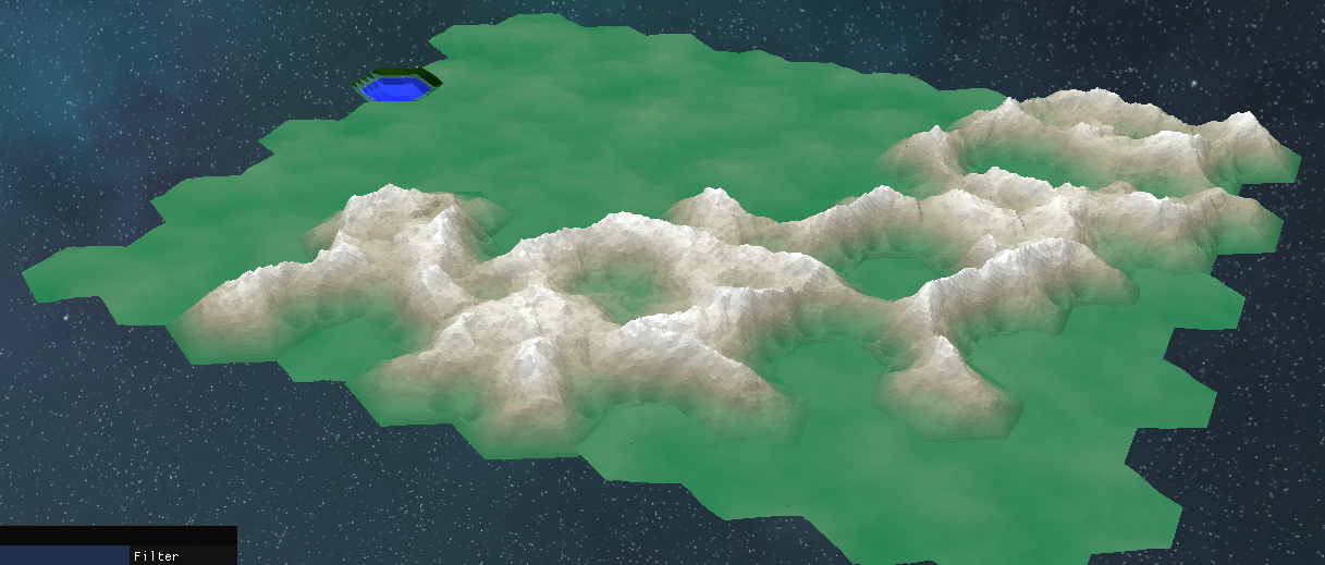
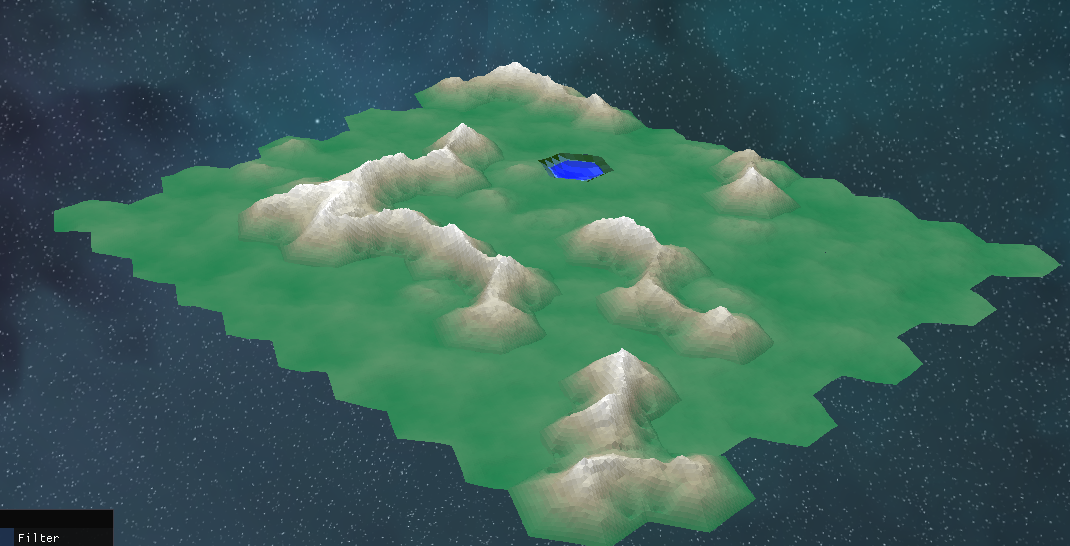
Final results:
Did you like this post? Tell us

Leave a comment
Log in with your itch.io account to leave a comment.